Description: War Thunder is a next generation military MMO game dedicated to...


The Nile is not only the main reservoir of the African continent, but also one of the longest rivers in the whole world. Taking the reserves of its tributaries, it is a life-giving force for the population located along its channel. This is an invaluable treasure of the "black continent", for the waters of which there were wars and states united, dams were built and dried-up lands came to life.
The most important water artery the hottest continent of the planet since ancient times was revered by its population as a source of life, well-being and prosperity. Thanks to the Nile, today we have the opportunity to get acquainted with Ancient Egypt, its architecture, art, science, wisdom, astronomical knowledge and religion. We can only guess what an important role the Nile played in the development of the largest civilization that had a huge impact on the life of mankind. As you know, about 20% of the length of the river is located on the territory of the modern state of Egypt. The state of agriculture, the quality of the crop and its quantity depend on the behavior of the Nile. Thus, the non-overflowing waters of the Nile are death for the population. In most cases, the river is always associated with Egypt, where the sacred waters guard the pyramidal tombs of the rulers of the state, the monumental sculpture of the Sphinx, the giant statue of Ramses, temples dedicated to outstanding pharaohs.
The Nile River is located in Africa and originates from the East African Plateau at an altitude of 1134 m. Not always calm in its course, but flat, the river passes through the territory of 7 countries, simultaneously uniting them with its waters. Among them is equatorial and multilingual Uganda, a country wildlife Kenya, unique Tanzania, the birthplace of mankind Ethiopia, the center of tropical epidemics the desert Republic of Sudan and contrasting Egypt. The Great River feeds the territory of these states for about 3 million years, saving the population from hunger and drought. It grew such historical centers of Egypt as Cairo, Luxor, Aswan, Giza and Alexandria, the capital of Sudan Khartoum.

With a length of 6852 km, the Nile crosses the following equatorial, subequatorial, tropical and subtropical. Most of its journey, which is more than 3000 km, it passes through the territory of the largest desert in the world - the Sahara.
The feeding regime of the river directly depends on climatic conditions. Nile is the annual floods of summer and winter period. The reason is related to the rainy season in the equatorial latitudes, where one of its tributaries originates. Thanks to this type of precipitation, the great river is full-flowing and fast-flowing. At this time of the year, the Nile can overflow its banks, flooding settlements and causing floods.
In winter, it is replenished with the waters of the White Nile, and in the summer - the Blue. Low water (the lowest water level) occurs in the month of May. The temperature indicators of the water of a hydrological object vary depending on the type of climate. The average summer period is plus 26 o C, winter - plus 18 o C.
Many researchers had disagreements among themselves about where the source of the Nile is located. Hard-to-reach jungles, hilly terrain with ledges and rapids, mosquitoes and crocodiles became an obstacle to a thorough study of a hydrological object. The riddle was cleared up only in the middle of the 18th century, thanks to the efforts of the London Geographical Society and the determination of its employees - the officer, traveler John Speke and the explorer of the river Samuel Baker.

The official opening of the beginning of the great river is considered to be 1864. The peculiarity of the Nile is that it has not one source, like most of the planet's rivers, but two. The main tributary with geographic coordinates (0 o N, 33 o E) originates in equatorial latitudes in Uganda, carrying its waters to Lake Victoria, and exits as the turbulent Kagera River. Overcoming ledges and at the same time replenishing supplies fresh water into the lakes of the mainland, the right tributary leaves the White Nile on the flat surface of the African continent.

The birthplace of the second source is the territory where the Blue Nile comes out. The confluence of two full-flowing tributaries occurs near the capital of Sudan - the city of Khartoum. Following in a northerly direction, a full-flowing river in a single channel carries vitality on desert territory into the Mediterranean Sea, forming a huge delta on its way.
The place where the river Nile flows geographical coordinates(31 o N, 30 o E). The shape of the mouth of the reservoir is no less unique than the history of the search for the source of the river. It, thanks to river sediments, forms a huge triangle, resembling the Greek letter "delta". At 160 km from the capital of Egypt, the city of Cairo, two large navigable branches are formed - Damietta and Rashid, as well as many small channels.

It is the Nile Delta that is considered the most fertile section of the famous river. More than 240 km stretches a unique natural formation along the southern coast mediterranean sea. This is the most populated part of Egypt and the entire course of the Nile. The scale of river sediment is simply stunning, their size is equal to the area of the entire Crimean peninsula.
vegetable and animal world The area where the Nile is located changes in its species composition, in the direction of the river. The richest parts of the zone are shrouds and light forests, less expressive are the areas of deserts and semi-deserts.
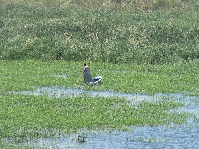
The water world is saturated with such representatives as the Nile crocodile, multifeathers, hippos and various fresh fish. About 300 species of birds nest on the banks of the river, many migratory and wintering representatives. But flamingos, pelicans, herons stand out especially.

The most interesting flora and fauna of the Nile delta and valley - papyrus, date palms, acacias, oleander, citrus fruits, reed beds, cattail and fern, cultivated vegetation. There are such representatives of the fauna as turtles, hippos, artiodactyls, reptiles and many insects. The leaders among the animal world are birds. The Nile River basin is simply a salvation for the established flora and fauna.
For any tourist, getting to the area where the Nile is located will not be a problem. The most fascinating and at the same time dangerous is the journey along the river. The source of the Nile is interesting for its inaccessibility. The place where the Nile flows into conquers with rich colors and amazing objects.
The distance between Moscow and the capital of Egypt on the map is more than 4000 km. For air transport in a straight line - about 3000 km and 4 hours of travel. Flights are organized by 8 airlines, where there are direct flights and with transfers in Istanbul. But where the Nile is most interesting is up to the tourist to decide. Not everyone likes the humid and hot jungle, someone loves warm sand, heat and pyramids.
The main difference between the Nile and most of the world's rivers is the direction of flow - from south to north. The nature of the river depends on the terrain. At the top, it looks like mountain river- boisterous and noisy. Hilly terrain, heavy rainfall help the river to work out the main channel with its flow. Downstream sacred river calm, quiet and navigable. Here, according to all the characteristics, we see that the object is the flat river Nile. The mainland of Africa, its homeland, is hot and deserted in the area of the confluence, and humid - at its source.
The section of the river with rapids and waterfalls is called the Victoria Nile, the calm Albert Nile stretches until the reunion of the tributaries into one channel, the most swampy section falls on the Bahr el-Jebel. Forming six rapids, the river created many problems with navigation for centuries, so the construction of the reservoir was simply a necessity. It solved the issue of transport movements and at the same time became a salvation for arid regions.
Unlike the Amazon, the Nile flows through the desert regions of the "black continent", but does not lose its full flow. It brings a lot of silty deposits, which are organic fertilizer, thereby doubling its advantage.

The Nile is not just a hydrological object of the planet. This is a ready-made natural route, stretching from the equator to the tropical borders. Its tourism possibilities are immense. For those who like to see more and faster, cruise trips along the river with stops in famous historical cities have been created:
lovers explore natural resources along the river, they may spend more time, but as a result they will get a brighter impression.
The unity of the Nile of Africa along its entire length gives the river a unique role as a bridge across different climatic zones.
Resembling a writhing snake, he spread the loop, according to the latest data, for 6695 kilometers. The tail “grows” just south of the equator, and the wide delta head is lowered into the Mediterranean Sea at 30 degrees north latitude. From this distance, the path of the Nile itself exceeds 3,500 kilometers. Thus, the Nile has by now won the competition for the right to head the list of world rivers from the Mississippi and the Amazon, although comparisons, especially with the latter, are relative.

The rolling country to the east of Lake Tanganyika is noticeably drier than the surrounding plains; red rocks are covered with shrubs and light forests. A stone's throw from the village of Kikizi in Burundi, several streams form the Luvironza River. It is a rather pathetic sight, but it is considered the most complete source from the delta, from which the Nile irrigates a basin of approximately 2,868,000 square kilometers. Luvironza is one of the upper tributaries of the Tanzanian Kagera, which, in turn, descends to the humid tropical forest- first along the border of Tanzania and Rwanda, and then, turning sharply to the east, separates Tanzania and Uganda.
Related materials:
The longest rivers in the world
At the end of the journey, it rapidly, like a water slide in a water park, flows into the world's largest lake Victoria. And the already full-fledged Nile leaves Victoria and from here it steadily tends to the north, through Uganda and Sudan - to Egypt. So, escaping from Victoria near the city of Jinja, the main industrial center of Uganda, and passing the equator, it falls into a narrow gorge, where it writhes like rapids.
Squeezed between the rocks, Big Hapi picks up its highest speed and does not lose it until the lake of Victoria's wife, Prince Albert. Having passed the border between Uganda and Sudan, the Nile of Africa receives the name Bahr el-Jebel, and then, having merged with the Bahr el-Ghazal river and many smaller tributaries, it becomes the White Nile (Bahr el-Abyad). In the meantime, woodlands give way to endless expanses of savannahs, where only rare acacias break the even horizon line. The climax comes in Khartoum, where the White Nile connects with the Blue (Bahr el-Azraq), which flowed here from Ethiopia, from Lake Tana. Now there are 330 kilometers left to the last tributary, the Atbara, - it is she, who also flows from the Ethiopian mountains, is considered the main carrier of the famous black silt, from which an entire civilization has grown. Now Neil is changing his temper again to stormy and writes out a huge S-shaped loop.
Related materials:
The longest river in the world - Amazon

Here he passes his famous rapids, the first one is north of Khartoum, the last (sixth) one is near Aswan, where the ascetic mountain ranges suddenly part and the “full-fledged” Valley opens up to the eye - a flat hollow, bordered by pink hills at sunset. Surrounded by the Libyan and Arabian deserts, it stretches from here for 840 kilometers - to the delta, the second largest in the world after the Brahmaputroganga. Photographs taken from space look like this: a thin green braid, having made several sweeping loops, dissolves in the fawn color of the desert. The population density map will show a thin red stripe crowding on a fertile valley among the sands - snow-white, that is, deserted. From the zoogeographic point of view, the Nile falls into two unequal regions, the boundary between which crosses its course south of the Tropic of Cancer, but north of Khartoum.
In the south - the Ethiopian region, which includes most of Africa, to the north - the Palearctic region, which includes a very significant part of Eurasia. A bridge of constant microclimate connecting spaces from Lake Victoria to the Mediterranean coast. Living conditions on it are approximately the same, but strikingly different from everything around.
Related materials:
Where do rivers start and end?

Along the entire course of the Nile, you can find tropical animals and plants that are in no way characteristic of the Palearctic. Along the entire course of this river, as in the rivers of tropical Africa, there are unique fish of the elephant-nosed family. The well-known Nile crocodiles and hippos - the classic inhabitants of the tropics - before the construction of the Aswan Dam could swim into the delta. In addition, the Nile is the most important axis for the movement of migratory birds. Its meridian bed serves as an excellent guide for those who, without a compass, want to move due south or north: for waders and pelicans, storks and swallows, using the Nile as the Road of Life.
In history, the Nile froze twice - in the 9th and 11th centuries.
Phenomenal cooling in historical time
* In the winters of 401 and 801 the waves of the Black Sea "hardened".
* The Nile froze twice - in the 9th and 11th centuries.
* In "859, the Adriatic Sea was so frozen that it was possible to walk to Venice." After 850 years (1709) this phenomenon was repeated.
* In 1010 - 1011, frosts fettered the Turkish coast of the Black Sea. Terrible cold reached Africa, where the lower reaches of the Nile River were covered with ice (the Nile also froze in the 9th century).
* In 1210-1211, the rivers Po and Rhone froze. In Venice, wagon trains traveled across the frozen Adriatic Sea.
* In 1322, the Baltic Sea was covered with such a thick layer of ice that from Lübeck in Denmark to the shores of Pomerania went by sleigh.
* In 1316, all the bridges in Paris were demolished by ice.
* In 1326, the entire Mediterranean Sea froze over.
* In 1365 the Rhine was covered with ice for three months.
* In 1407-1408, all Swiss lakes froze over.
* In 1420 there was a terrible death rate in Paris from the cold; wolves ran into the city to devour the corpses lying unburied in the streets.
* In 1468, wine in the cellars froze in Burgundy.
* In 1558 [90 years later] an entire army of 40,000 men was camped on the frozen Danube, and in France frozen wine was sold by the weight.
* 1645-1705, Europe - "Little Ice Age". In Holland, then all the canals froze, and in Greenland, due to the advance of glaciers, people were forced to leave part of the settlements.
* In 1709, it was -24 degrees in Paris for many days; the wine froze in the cellars and the bells cracked as they rang. Even the Nile froze.
* In 1795 [after 86 years] frost in Paris reached 23 degrees, and the French squadron stormed the entire Dutch fleet, captured by ice off the coast of France.
* In the 20th century, in the winter of 1953 - 1954 [and the summer of 1953 was also cold] in a vast territory from the Atlantic to the Urals, from November to April, the cold was fierce, it froze Northern part Black and the entire water area of the Azov Seas.
* The winter of 1962-1963 was also remembered for burning frosts and ferocious snowstorms. Ice bound the Danish Strait, which usually does not freeze, and the canals of Venice and the rivers of France froze again.
* The season of 1968-1969 is also named "Winter of Furious Frosts".
* In the Sahara desert once - February 18, 1979 - it was snowing.
* In 2002, in Germany, due to frost, the movement of ships along the Main-Danube canal, which is an important European water transport artery, was completely stopped. The thickness of the ice, in which more than 20 ships froze, reached 70 cm in some places. At the same time, due to severe cold, the Venice lagoon froze, the gondolas froze into ice. Prior to this, the lagoon froze over in 1985.
* At the end of 2005, most of the countries of Central and Western Europe were at the mercy of heavy snowfalls. In Germany, unusual for this time of year cold has led to icing and breakage of power lines.
I express my gratitude to V. V. Akimov for his help in substantiating the post with references to the sources of information used about unprecedented cold snaps. So links:
Chronicle of the Byzantine Theophanes from Diocletian to the kings Michael and his son Theophylact (can be downloaded on my former website, below the bases)
http://livehistory.ru/forum.html?func=view&catid=18&id=6
Chronograph of Vardapet Airivansky
http://www.vostlit.info/Texts/rus11/Mhitar/frametext1.htm
Chronograph Russian
Retelling of the book by E.P. Borisenkov, V.M. Pasetsky "The Millennial Chronicle of Extraordinary Natural Phenomena"
http://www.randewy.ru/gml/meteo11.html
Page "Climatology" on the site of Igor Garshin.
http://garshin.ru/evolution/geology/geological-evolution.html
Vadim Vadimovich kindly points to the following sites:
- "Byzantine Chronicle"
http://www.anapa-oskar.ru/ch1_upominanij_o_severo_vostochnom_prichernomore-11.html
http://www.stengazeta.net/article.html?article=1977
http://gochs.info/p85.htm
AND NOW TO THE ESSENCE OF THE QUESTION
My database of catastrophic events contains 51 severe cold snaps and 107 severe frosts. But of greatest interest are evidence of the freezing of the southern seas - the Black, Adriatic and Mediterranean, as well as the Nile Delta and the non-freezing soda lake Van (the Khlatskoye Sea).
The problem is that these record cold snaps recorded in annals, chronicles and chronographs do not coincide with scientific data. 11 out of 14 winters in which freezing of the southern seas is witnessed - outside the Maly ice age. Here is the chart for this period.
And here is the evidence; 79% of the evidence is in the "temperature optimum".
401 in the winters of 401 and 801 the waves of the Black Sea "hardened"
696 The sea of Chlatskoe is frozen
739 Cruel winters also took place in 739, when the Bosphorus froze
742 "And the winter was fierce: the Pontic Sea froze to 30 cubits"
762 (l. m. 6255, p. ch. 755) part of the sea a hundred miles from the coast turned into stone thirty cubits deep, and the same was from Zikhia to the Danube, from the Kuphis river to the Dniester and Dnieper and to the Dead gates, from all other coasts to Mesimvria and Media
763 In the winter of 763-764, the Black Sea completely froze over: it was possible to ride a sleigh on thick ice, “as if on land”
801 in the winters of 401 and 801 the waves of the Black Sea "hardened"
829 ice bound the Nile Delta
859 The Adriatic Sea was so frozen that it was possible to walk to Venice
1010 - 1011 Terrible cold reached Africa, where the lower reaches of the Nile River were covered with ice
1011 The waters of the Black Sea were bound by ice, even the Bosporus was frozen. When the wave of cold reached North Africa, even the Nile River was covered with ice.
1210-1211 in Venice, the frozen Adriatic Sea went wagon trains
1326 the entire Mediterranean Sea froze over
1601 on the Black Sea to Constantinople went on a sleigh
1709 in the vicinity of Venice, the Adriatic Sea was covered with "stagnant ice"
1754 Canals froze in Venice, ice in the area of the Black Sea Straits
There are 18 dates in total: 401, 696, 739, 742, 762, 763, 764, 801, 829, 859, 1010, 1011, 1210, 1211, 1326, 1601, 1709, 1754. However, there are somewhat fewer winters on these dates - only 14 - for an obvious reason: winters capture two calendar years each.
And 11 out of 14 of these winters, that is, 79% fall on the so-called. "medieval temperature optimum" - an exceptionally warm period. This is how the top graph looks like in comparison with the trend of the dates of major cold snaps in the annals.

Thus, there is a serious conflict between the data of scientists, glaciologists and climatologists, on the one hand, and the data of historians, on the other.
Not so long ago, a fairly powerful office, the IPCC, joined this conflict. Here is a quote from Wikipedia.
“... known as the second climatic optimum, the medieval climatic optimum. The existence of this period in the Northern Hemisphere (Europe and Siberia) in the 8th-13th centuries with temperatures more than 1°C higher than modern ones (in Greenland - up to 2°C) is not in doubt.
A number of experts dispute global warming during a small optimum. For example, the position of the Intergovernmental Panel on Climate Change (IPCC) changed from 1990 to 2001 from recognition to non-recognition of the medieval optimum (see comparison of temperature charts from IPCC reports on the right). One of the leading proponents of the anthropogenic theory global warming(AGP) Michael Mann wrote on June 4, 2003: "it would be good to try to limit the imaginary medieval warm period, although we do not yet have a temperature reconstruction for the hemispheres for that time." Critics of the AGP claim that proponents of the theory underestimated the temperatures of the Medieval Warm Period without justification for the purpose of declaring modern temperatures unprecedented high."
Suspicions of the political involvement of the IPCC have existed for a long time. Definitely speculative conclusions about the contribution of humanity to the level of carbon dioxide. The gross (already recognized) mistakes of the IPCC in expert opinions melting Himalayan glaciers. It is very likely that this structure to some extent serves the interests of large financial institutions Europe.
Nevertheless, I think that the IPCC will win, glaciologists will be forced to reconsider their views on the medieval “temperature optimum”, and it is difficult to predict the consequences of this for us.
Description: War Thunder is a next generation military MMO game dedicated to...

"Titan Siege" is a large-scale online game on the theme of Scandinavian and ancient Greek...

Being an avid lover of German tank looks, I spent a lot of time...