For almost three years, the Ryazan Higher Airborne School has been commanded by Anatoly...


Reading the history of the Second Kamchatka Expedition of Vitus Bering, I noticed many blank spots in the official version. For example, there is no exact information about how he died. Some of the sailors on his ship were sick and died of scurvy, but he himself showed no signs of scurvy on his teeth. I decided to study this issue and while browsing materials on the Internet, I came across an interesting article. Of course, it does not provide reliable evidence, the information is at the OBS level (one grandmother said), but nevertheless the theory is very interesting and I would not be surprised if this is how it actually happened, as outlined in this article below.
Bust and a portrait of the navigator Vitus Bering drawn on it. He was born in 1681 in the Danish city of Horsens, graduated from the cadet corps in Amsterdam and in 1703 entered service in the Russian fleet. From the rank of second lieutenant he rose to the rank of captain-commander. He had not been to his homeland since 1715, having become Russified.
For two and a half centuries, it was believed that the navigator Vitus Bering died of scurvy. An archaeological expedition to the Commander Islands and the exhumation of Bering's body in 1991 refuted this belief. As it turned out, there were simply no signs of this disease on the teeth of the great navigator. But what caused the death of Vitus Bering, scientists could not answer. Olga Sotnikova told Smena her version of the events of those years. Her great-great-grandfather set sail in June 1741 on the packet boat “St. Peter" together with Bering.
Olga Petrovna spent her entire life in Kamchatka. Her ancestors lived here even before Bering founded Petropavlovsk in October 1740. Now the woman is nearly seventy, and she sacredly treasures the memories that were passed on to her by her grandfather - the great-grandson of the same Alexei Sotnikov, who was a sailor on the Bering packet boat. She is sure that the great navigator died a violent death. He was simply dealt with by the sailors who, through the commander’s fault, found themselves thrown onto an uninhabited island (now Bering Island in the Sea of Okhotsk).
“They could not forgive Bering for dooming them to death,” says Sotnikova. “When half of the packet boat’s crew had already died from cold and scurvy, the remaining sailors tied the commander to a board and buried him alive in the ground.
This portrait of the Danish court poet Vitus Pedersen Bering was for a long time considered a portrait of a navigator. In fact, the poet was the commander’s uncle and he got his name in honor of him. What the navigator actually looked like was established only in 1991, when, in honor of the 250th anniversary of Bering and Chirikov’s voyage to the northwestern coast of America, the International Society “Underwater World” and the “Adventure” club of Dmitry Shparo, together with the Institute of Archeology of the USSR Academy of Sciences, organized expedition to Bering Island. Then his grave was discovered and his real appearance, clearly more masculine, was reproduced from his skull.
Bering went on his last voyage as commander of the 2nd Kamchatka Expedition. His task was to find the strait separating Kamchatka from America.
“By June 1741, Bering was already on the verge of a nervous breakdown: the expedition for which he had been preparing for 10 years could fail at any moment due to the theft of officials who plundered money to equip the ships,” the woman says. “The atmosphere inside the expedition was also tense - its participants were seriously afraid that Bering would order to sail to America without having the necessary supply of food on board.
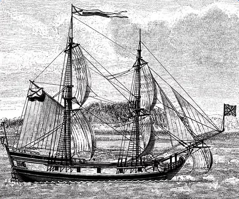
We set off on the voyage on two packet boats - “St. Paul” and “St. Peter”. The first was commanded by Captain Alexey Chirikov, the second by Bering. A few days later, the ships were lost in the fog, and Chirikov’s packet boat was the first to reach America. Two days later Bering sailed. But this time the captains managed to miss each other.
“My great-great-grandfather told me how the Indians mocked the Russians when they reached their land,” says Olga Sotnikova. “There were only 20 liters of water left on Bering’s packet boat, and every drop was worth its weight in gold. When the Russians offered the Indians tobacco and jewelry in exchange for water, they agreed. But when the exchange took place, the Indians, in front of Bering’s eyes, poured water into the ocean. The Russians were afraid to enter into an open conflict with them and go looking for water on their own, because there were hundreds of Indians around, and about 70 Russians.
 Brig “St. Peter.” The widespread assertion that Europeans (Russians) discovered the shores of Alaska precisely during the Second Kamchatka Expedition is incorrect. The first Russian ship to approach the coast of Alaska was the boat “St. Gabriel" on August 21, 1732 during the expedition of A.F. Shestakov and D.I. Pavlutsky. In addition, there is fragmentary information about Russians visiting America in the 17th century. Bering only sought to further explore this region, but his expedition ended in disaster. She was destroyed, among other things, by the Admiralty's instructions to look for the non-existent Company land, supposedly consisting of pure silver. Because of this, the ships instead of the 65th parallel walked along the 45th, which almost doubled their path to the American shores.
A day later, Bering decided to return to Kamchatka without replenishing fresh water supplies.
“He suggested that the Indians might not mind trying human meat,” says Olga Petrovna. – Later it turned out that Bering was right. Two days earlier, Chirikov launched three boats with people, but they never returned.
On the way back, Bering's packet boat ran into a storm. Part of the team fell ill with scurvy from the cold, lack of vitamins and fresh water - 12 people died, 34 did not get out of their beds. Bering himself caught a cold. By that time, the ship was already uncontrollable and was floating in the ocean like a log. On November 4, the ship washed out onto a ridge of uninhabited islands, later named Komandorsky Islands. 20 people died on the island, unable to cope with the disease.
– When the sailors saw that the land was not connected to the mainland, and Kamchatka was not visible even with a telescope, a riot began on the island. It was headed by assistant commander Swede Sven Waxel, says Sotnikova. “He convened a council and removed Bering from command of the expedition. The sailors insisted on building a new ship from the remains of the packet boat (there was no forest on the island), but Bering did not want to hear about it. He hoped that Chirikov's packet boat would sail past on the way to Petropavlovsk and pick them up. The sailors waited a month. On December 8, the commander and five of his followers had to be killed to begin construction of a new ship.
 Bering's ship is shipwrecked. A number of geographical objects (Bering Sea, Bering Strait, Bering Island, Bering Cape, etc.) were named after Bering at the suggestion of Europeans. It would be more appropriate to call the Bering Strait the Strait of Semyon Dezhnev, who discovered it back in the 17th century. However, Dezhnev’s report got stuck in the bureaucratic grindstones and was found only after Bering’s expeditions.
On August 14, 1742, the surviving members of the 2nd Kamchatka expedition sailed to Kamchatka on a new ship. It landed in Petropavlovsk Bay a year after the return of the packet boat Alexei Chirikov.
The sailors placed a wooden cross on the commander’s grave, but by the end of the 18th century it disappeared. In 1874, another cross was erected on the Commander Islands at the site of Bering’s possible burial. In 1966, geographers admitted that the previous burial site had been determined erroneously, and installed the third tombstone on the island. Finally, in 1991, an archaeological expedition to the Commander Islands took place. Scientists have discovered the very burial place of six people that Olga Sotnikova spoke about. According to the expedition report, “one of the burials, designated No. 6, differed from the others in the presence of a wooden coffin, the deepest grave pit and almost central location.” It is quite possible that archaeologists mistook the very board that Sotnikova recalled for a coffin.
Scientists loaded the sailors' bones into boxes and took them to Moscow for examination. As it turned out, the skull of one of the sailors really belonged to Vitus Bering, although scientists did not find any traces of scurvy on it. But experts managed to reconstruct Bering’s appearance. As it turned out, the well-known portrait of the commander, published in textbooks and books on geography, depicts not Bering himself, but his uncle.
Six coffins containing the remains of the commander and his sailors returned to the island in 1992. After the funeral service, the ashes of the seven sailors were interred according to Orthodox custom in Commander Bay.
 The grave of Vitus Bering on the Commander Islands.
In 1991, archaeologists established not only the exact location of Bering’s grave, but also found things from the navigator’s packet boat. They managed to find 7 cannons, cannonballs and the commander’s personal belongings - scissors and a knife. Some of the things were given to the descendants of the Commander, and the cannons and cannonballs were transported for storage to the Petropavlovsk Local History Museum.
Natalya Divnina, director of the museum, does not rule out that the sailors really decided to take revenge on Bering for their suffering and buried him alive. But another version seems more convincing to her.
“Bering himself could have asked the sailors to bury him in the ground to reduce the pain of scurvy,” the museum director told the Smena correspondent. “Maybe he died during one of these procedures.”
It is still unclear to scientists whether Bering died a violent death or a natural one.
Bering Vitus Jonassen (1681-1741) – great Russian navigator, captain-commander of the Russian fleet. He headed the First and Second Kamchatka expeditions. There was a strait between Alaska and Chukotka, which was later named in his honor - the Bering Strait. An island and sea in the North Pacific Ocean are also named after the navigator. Bering's expeditions led to the discovery of a number of islands in the Aleutian chain.
Vitus was born on August 2, 1681. He was Danish by origin. Very little is known about his early years. There is evidence that Bering was born in the Danish city of Horsens, where on the fourth day after his birth the boy was baptized in the local Lutheran church. The document of his baptism is still kept in the old church register of the city of Horsens. The child was named in honor of his uncle (mother’s brother), he was a famous Danish historian, worked as a court chronicler at the Royal Court. She inherited the surname Bering from her mother; their noble family was quite noble in Denmark, but by the time Vitus was born it was already bankrupt.
On his father's side, the boy inherited the middle name Jonassen. The father of the future navigator, Jonas Svendsen, was married to Anna Pederdatter Bering for his second marriage, and from his first he had two sons and two daughters. Anna gave birth to her husband five children - three boys and two girls. My father worked as a customs officer and was a highly respected man in the city. The family was not wealthy, but both parents and children were educated and pious.
The Berings lived on Søndergade Street at house number 59. And on the neighboring Smedegade Street there was a school that Vitus attended. The educational institution belonged to Peder Lauritzen Dahlhoff, whose son Horlov married Bering’s sister Anna Katrins in 1695. Khorlov served in the Danish Navy as a fanfarist, so conversations about the sea and naval life often took place both in Bering’s house and at school.

From early childhood, Vitus began to make friends with sailors and skippers, and often visited them on their ships. At that time, Denmark was actively conquering maritime territories, the king sent expeditions all over the world. Young Bering was fascinated by the sea and studied in detail the materials of the expeditions of Jens Munch, who at the beginning of the 17th century sailed to the island of Greenland and India.
Despite the fact that the family had financial difficulties, Jonas and Anna tried to give their children a good education. Vitus's two older brothers studied at the University of Copenhagen. But young Bering chose a different path for himself. After graduating from school, the fourteen-year-old teenager signed up on a Dutch ship as a sailor.
Together with his cousin Sven and comrade Sivere, who later became a Russian admiral, Bering twice took part in voyages to the East Indies, crossed the North Atlantic, and visited the European colonies on the west coast of North America and the Caribbean islands. Vitus gained experience in travel, but his knowledge in maritime affairs was not enough. And then Bering continued his studies in the naval cadet corps in Amsterdam, which at that time was considered the best in the world. The young man learned maritime sciences easily, and even then it was clear that he would make an excellent navigator.
In 1703, Vitus met the vice-admiral of the Russian fleet, Cornelius Ivanovich Kruys (he was Norwegian by origin). Then, on the instructions of Tsar Peter I, throughout Europe, his agents searched for and recruited intelligent foreigners (sailors, military and other specialists) to serve in Russia. In Amsterdam, Kruys was engaged in such work. He immediately drew attention to the character traits and qualities of the young Bering, which were highly valued in the naval service. In 1703, Korneliy Ivanovich invited Vitus to enlist in the Russian fleet. The young man accepted this offer; he had just graduated from the cadet corps with the rank of officer.
With the assistance of Cruys, Bering was enlisted in the Russian Baltic Navy with the rank of second lieutenant. In 1704, Vitus came to Russia, and from now on his fate was forever connected with this country. First, he was put in command of a small ship that delivered timber to Kotlin Island from the banks of the Neva, where Peter I began the grandiose construction of the naval citadel of the Russian fleet of Kronstadt. Bering showed diligence and zeal in his service. He was increasingly entrusted with responsible tasks, the implementation of which he was zealous and very scrupulous. Such service, talent and passion for navigation were appreciated and in 1707 Vitus was already awarded the rank of lieutenant.


However, during seventeen years of service, Bering failed to receive the desired rank of captain of the 1st rank, even though under his command in 1720 there was a frigate with ninety guns, and during the Northern War he more than once carried out special orders from the Sovereign. Vitus believed that he was undeservedly passed over for awards and promotions. In this regard, in February 1724, when the Northern War ended, he wrote a letter of resignation.
Vitus' request was granted. But when Tsar Peter I learned of his resignation, he told Admiral General of the Russian Fleet F.M. Apraksin: “You shouldn’t offend Bering. This Dane became a truly Russian man and proved this with his service. Announce at the Board that he has been re-admitted to the navy and appointed captain 1st rank.” In August 1724, Vitus was recalled from retirement and taken command of the frigate Selafail with sixty guns.

One of the great merits of Peter I is that he became the founder of the scientific study of the geography of Russia and surrounding territories. At the end of 1724, the Tsar issued a decree on organizing the First Kamchatka Expedition and instructed the Admiralty Board to select the most suitable leader. Peter I was offered to entrust this matter to Bering, to which the sovereign's consent was given. He personally described to Vitus the main tasks of the expedition:

Bering and his team set out from St. Petersburg in January 1725. For two years, they traveled by river boats, on foot, and on horseback through Siberia to Okhotsk. Here they spent the winter, after which they sent their equipment to the mouth of the Kamchatka River on boats and dog sleds. In the summer of 1728, having settled on the eastern coast of the Kamchatka Peninsula, Bering and his expedition completed the construction of the first boat, St. Gabriel. By the end of summer, the ship moved along the mainland to the northeast, as a result of which the following were placed on the map:
The expedition entered the Chukchi Sea through the Strait, which later became known as the Bering Strait, and turned home. Despite the fact that the North American coast was not discovered, Vitus considered the task completed - during the expedition it became clear that America and Asia are not connected. Having circled Kamchatka from the south, he also mapped a large ice-free bay in the Pacific Ocean, Avacha Bay and Kamchatka Bay in the eastern part of the peninsula. After this, in the spring of 1730, Bering and his team returned to St. Petersburg through Okhotsk, and then across all of Russia.

Upon his return, the navigator provided a report in which he confidently spoke about the comparative proximity of Kamchatka and America and that it would be advisable to establish trade relations with the Americans. Having traveled back and forth through Siberia, Vitus was sure that on these lands it was possible to mine salt, iron ore and grow rye, barley, and vegetables. The navigator also presented his plans on how to further explore the Russian Asian coast in the northeast, and explore sea routes to the Japanese islands and America.
After listening to his thoughts and plans, in 1733 the Collegium again appointed Bering as leader of the Second Kamchatka Expedition. They considered that the tasks of Sovereign Peter I were not fully completed: the expedition did not visit the American shores and did not fully prove that there was no connection between Asia and America. Nevertheless, Bering was awarded the rank of captain-commander and a bonus of one thousand rubles.
At the beginning of 1734, Vitus went to Yakutsk, where for three years he prepared expeditionary equipment and food. The local authorities did not want to help Bering; every now and then he was faced with their resistance, indifference and inaction. Only in the fall of 1740 did they set off from Okhotsk to the east of Kamchatka on two packet boats, St. Paul and St. Peter.

In July 1741, the expedition reached the coast of North America. Back Bering followed along the Aleutian ridge and the southern coast of Alaska. The following islands were discovered and mapped:
The return journey from the Second Kamchatka Expedition turned out to be very difficult. The sea was completely shrouded in fog and began to become very stormy. Because of the fog, not only the shores were not visible, but also the stars by which the location of the ship could be determined. Months passed, and the Saint Peter was still on the high seas. The crew members began to develop scurvy, and some began to die. Bering himself also fell ill, but with the last of his strength he led the packet boat and the surviving members of the crew.

The ship was practically uncontrollable and moved along the waves and winds. At the beginning of November 1741, snow-covered land was noticed on the horizon, which later received the name Bering Island. It was decided to arrange a forced winter here. The sick were taken out of the stuffy cabins first, but they soon died in the fresh air.
On December 8, 1741, Vitus Bering also died in a hastily built dugout. On the very edge of vast Russia, the great navigator, stricken with scurvy, tried with all his might to cling to life; the disease turned out to be stronger. He did not know then that he was passing away on the island that would later bear his name. I also didn’t know that the Bering Sea would be called the Pacific Ocean and the strait that separates America from Asia. The accuracy of these studies was later confirmed by the English navigator James Cook. It was his proposal to name the strait between Chukotka and Alaska the Bering Strait.

In 1713, Bering married Anna Christiana Pulse, the daughter of a Swedish merchant. In the summer of 1716, their first child was born, named Vitus in honor of his father. Unfortunately, the baby soon died. After this, Anne Christiane gave birth many times, but most of the children died in infancy. During the first five years of their married life, the Bering couple lost five children. The girl Annushka and three sons, Jonas, Thomas and Anton, survived.
13:24 — REGNUM
Meeting of Russians with Aleuts. Drawing by Sven Waxel. 1741

Russian map of the Far East. 1745
“On May 29, 1741, the second Kamchatka expedition began. Two packet boats left Avacha Bay, where Petropavlovsk-Kamchatsky is now located: “St. Peter" - under the command of the chief of the expedition, Vitus Bering and "St. Pavel" - under the command of Alexei Chirikov.
On June 20, thick fog separated the ships, and they continued their further voyage separately. But both ships reached the unknown shores of America. And the discoveries of the two captains - Bering and Chirikov - subsequently complemented each other well.
Hurricane winds characteristic of the North Pacific began. It was dangerous to continue sailing off the American coast. And Bering decided to return to Kamchatka.
A fierce and prolonged storm awaited the pioneers on their way back. For almost seventeen days he did not let go of the packet boat "St. Peter" from his arms. Neither experienced officers nor the captain-commander himself could accurately determine the location of their ship.
On November 4, 1741, the watchman saw land similar to the coast of Kamchatka. By this time, almost the entire team was suffering from scurvy. The storm tore the shrouds. It became almost impossible to use the sails.
The death of the ship and people seemed inevitable. A council was held around the sick Bering. Everyone who could get to his cabin took part. After arguing, they decided to approach the shore.
However, trouble awaited the pioneers here too. The rotten anchor rope burst, and the ship, caught by the breakers, was carried towards the coastal reef.
Here it is, death!.. People knelt down, prayed, and said goodbye to earthly life.
But a miracle happened. A huge wave came and threw the ship over the rocks. The packet boat found itself not far from the shore, in calm water.
Most of the expedition members did not yet know that this land was not Kamchatka, but an uninhabited, deserted island.
Exhausted travelers landed ashore. They began to dig holes for housing. They were covered on top with the remains of sails.
The crew of "St. Peter" was melting every day. During the landing alone, 12 people died. The patients were placed in pits, covered with canvas and covered with sand on top. This helped to keep warm and saved helpless people from being bitten by arrogant Arctic foxes. There were many of them on the island, and they were not at all afraid of the aliens.
The absence of trees in the uncharted land was compensated for by driftwood washed ashore. They had to eat mainly birds. Battered by storms, the St. Peter was unseaworthy. It was necessary to build a new ship from the remains of the old one. But a long, blizzard winter was approaching, and the return to Kamchatka was postponed for a year.
Of the 77 crew members, only 46 survived.
On December 8, Captain-Commander Vitus Bering died of scurvy. He died, like other sailors, in a hole, half-buried with sand. During his illness, the commander did not allow himself to be dug up. It seemed to him that it was warmer under a thick layer of sand.
Senior Lieutenant Sven Waxel took command of the expedition. At the officers' council, at his suggestion, the island was named after Bering."
Quoted from: Burlak V.N. Walking to the cold seas. M.: AiF Print, 2004
Sven Waxel, from the book "The Second Kamchatka Expedition of Vitus Bering":
Captain-Commander Bering died on December 8. His body was tied to a board and buried in the ground; all our other dead were buried without boards.
I cannot help but describe the sad state in which Captain-Commander Bering was at the time of his death; his body was half buried in the ground already in the last days of his life. It would, of course, be possible to find means to help him in this situation, but he himself did not want this and pointed out that those parts of the body that are deeply hidden in the ground remain warm, and those that remain on the surface are very cold. He lay separately in a small sandy pit - a dugout, along the walls of which sand was gradually crumbling all the time and filled the hole to half, and since he was lying in the middle of the dugout, he was treated so that his body was half covered with sand.
After the death of the commander, I, as the senior in rank, had to take command. Although at that time I was lying completely exhausted from illness, I still had to get down to business. I decided to lead the team as meekly and gently as possible, since rigidity and severity would be completely inappropriate under such circumstances and would not lead to any results.
Quoted from: Vaksel S. Second Kamchatka Expedition of Vitus Bering. M.: Glavsevmorput, 1940

Miniature depicting Nadir Shah. Unknown artist. 1769
“On the Arabian Peninsula, the power of the Turkish conquerors was never strong. In 1633, as a result of popular uprisings, the Turks were forced to leave Yemen, which became an independent feudal state. But they stubbornly held on in the Hejaz: the Turkish sultans attached exceptional importance to their nominal dominance over the holy cities of Islam - Mecca and Medina, which served as the basis for their claims to spiritual power over all “devout” Muslims. In addition, during the season of Hajj (Muslim pilgrimage) these cities turned into grandiose fairs, centers of lively trade, which brought significant income to the Sultan’s treasury. not only did not impose tribute on the Hijaz, but, on the contrary, obliged the pashas of the neighboring Arab countries - Egypt and Syria - to annually send gifts to Mecca for the local spiritual nobility and provide generous subsidies to the leaders of the Hijaz tribes through whose territory the caravans of pilgrims passed. For the same reason. real power within the Hijaz was left to the Meccan spiritual feudal lords - the sheriffs, who had long enjoyed influence over the townspeople and nomadic tribes. The Turkish Pasha of Hijaz was essentially not the ruler of the country, but the Sultan’s representative to the sheriff.
In Eastern Arabia in the 17th century, after the expulsion of the Portuguese from there, an independent state arose in Oman. The Arab merchants of Oman had a significant fleet and, like European merchants, engaged in piracy along with trade. At the end of the 17th century. they took the island of Zanzibar and the adjacent African coast from the Portuguese, and at the beginning of the 18th century. expelled the Iranians from the Bahrain Islands (later, in 1753, the Iranians regained Bahrain). In 1737, under Nadir Shah, the Iranians tried to capture Oman, but the popular uprising that broke out in 1741 ended with their expulsion. The leader of the uprising, the Muscat merchant Ahmed ibn Said, was proclaimed the hereditary imam of Oman. Its capitals were Rastak, a fortress in the mountainous interior of the country, and Muscat, a commercial center on the sea coast. During this period, Oman pursued an independent policy, successfully resisting the penetration of European merchants - the British and French, who tried in vain to obtain permission to establish their trading posts in Muscat."
Quoted in: World History. Encyclopedia. Volume 5. M.: Publishing house of socio-economic literature, 1958
; the first of all European navigators visited the Kamchatka and Bobrovskoe seas, later called the Bering Sea, and discovered the chain of Aleutian islands, Shumaginsky, Tumanye islands, the northwestern part of America and St. Elijah Bay.
Here he presented the government with his journal, maps and two proposals, in which, among other things, he expressed his desire to equip a new expedition to explore the northern regions. and north-east coast of Siberia. The Admiralty Board, which examined his journal and maps, although it did not entirely trust B.’s discovery, nevertheless, in view of the “difficulty of the expedition,” requested him the rank of captain-commander and a monetary reward of 1000 rubles. B.’s “proposals” were approved by the Senate and the Admiral College, and this approval was followed (December 28) by the highest permission to appoint a new expedition, known as second Kamchatka expedition. Its goal was to explore the shores of the Arctic Ocean from the Dvina in the east to the strait between the continents and the sea and sail to America. To better achieve this goal, the expedition was divided into several detachments. One of them, under the command of Muravyov and Pavlov, began exploring the shores from the. Dvina to Ob. During 1734-35. they only managed to reach Mutnaya Bay. Next year Muravyov, who was put on trial together with Pavlov for “indecent offenses,” was replaced by Lieutenant Malygin, who in September (?) finally reached the mouth of the river. Obi.
Another detachment, which was assigned to sail from the. r. Ob to the Chukotka Nose, was under the command of Lieutenant Ovtsyn. But the latter was somehow constantly caught by winter at the time of sailing, and during all three years ( - ) he only managed to get up the Ob to 72 ° 30 "N. Latitude. Of the other members of this detachment who acted for independent research, one should point out Lieutenant Pronchishchev, who managed to get to Taimyr (city), Lassenius, who died along with a significant part of his detachment in Kharudy, between Yana and Indigirka (city), and Lieutenant Laptev, who had almost more than all the participants (after Chirikov) of the Second Kamchatka Expedition have the right to remember him as an energetic, active and happy traveler.
Bering's surviving companions honored their commander as best they could: they took his body out of the pit in which he stood, waist-deep covered in sand from the cold, buried him and placed a wooden cross over the grave, replaced in
Vitus Bering. Reconstructed image
More than eight years have passed since leaving St. Petersburg. Such a considerable period of time was spent on preparatory and organizational work, obtaining the necessary resources and materials and, most importantly, on a protracted and stubborn struggle with the local bureaucratic apparatus, which was not accustomed to the supervision of the capital. The course that the expeditionary packet boats “St. Peter” and “St. Paul” moved was chosen in advance, after much discussion and debate. According to the maps available to the expedition's professor of astronomy, Louis de la Croer, it was in the southeastern direction that the mysterious and vast land of Juan de Gama should be sought. It was quite often depicted in the works of cartographers of the 18th century. None of those who took part in the meetings before departure knew that the map presented by the professor was erroneous, and the land indicated on it was nothing more than a myth. This misconception played a certain role in the fate of the expedition, but there was still more to come.
Emperor's plans
Peter I was an active and energetic person. Throughout his reign, Russia had to fully taste the fruits of his labors and decisions made. There were projects and ideas that were conceived and implemented on time. There were those that the emperor, who died by no means at an old age, did not get around to implementing. The emperor was passionate about the idea of bringing his country out of the provincial backwaters, reaching rich and exotic countries in order to establish trade with them. To realize these royal aspirations, not only sharp soldiers' bayonets and guns of battleships and frigates were required. What was needed was detailed information about distant lands and territories and finding ways to get to them. Back in 1713, Fyodor Saltykov, an associate of the Tsar who had been a naval agent in London for a long time, presented the idea of building ships at the mouth of the Yenisei in order to go around Siberia along the coast and find islands and lands that could be developed, or establish trade relations with China .
However, only in 1724, at the end of his reign, Pyotr Alekseevich finally began to implement such a project, that is, to explore the route through the “Arctic Sea” to India and China. The Emperor believed that in this field the Russians could achieve great success and ultimately get a shorter route to sources of expensive colonial goods. In December 1724, Peter signed a decree on organizing a geographical expedition with broad tasks. She had to finally find out the location of the strait between Asia and America, study the Far Eastern shores of Russia and, first of all, Kamchatka. For this purpose, it was prescribed to manufacture two vessels on site, on which it was planned to carry out sea voyages.
The command of the expedition was entrusted to the Dane Vitus Jonassen Bering, who had been in Russian service for 21 years. This choice was not accidental, and the emperor, who was scrupulous in personnel matters, would not have placed a random person in such a responsible position. Bering was born in 1681 in Copenhagen and at the time of his appointment he was an experienced and competent officer - he was already 44 years old. Having graduated from the cadet corps in Amsterdam in 1703, in the same year he went to Russia, which was in dire need of qualified and trained naval personnel. A big role in making this decision was played by Bering’s meeting with Admiral Cornelius Cruys, who, on behalf of the Tsar, dealt with personnel issues in Europe. By this time, Bering already had a voyage to the East Indies under his belt.
The young sailor was accepted into Russian service without delay with the rank of second lieutenant. He took part in the events of the Northern War, and in 1710 he was transferred to the Azov Fleet, where he already commanded the shrewd “Munker” with the rank of captain-lieutenant. After the unsuccessful Prut campaign and the end of the Russian-Turkish war, Bering again found himself in the Baltic, where the struggle with the still strong Sweden continued. The Dane served regularly and confidently moved up the career ladder: in 1719 he commanded the ship “Selafail”, which made a difficult voyage from Arkhangelsk to Kronstadt, and later, in 1720, the ships “Malburg” and “Lesnoye”. The latter was at that time one of the largest ships of the Baltic Fleet and was armed with 90 guns. In the same year, Bering received the rank of captain of the 2nd rank. In 1724, at the time of the decision to organize the Kamchatka expedition, he was already a captain-commander.
First Kamchatka expedition

Initially, the expedition consisted of 37 people. On January 24, 1725, during the last days of the reign of Peter I, she left St. Petersburg and headed through Siberia to Okhotsk. Subsequently, the expedition's personnel expanded and at times reached 400 people, including soldiers, sailors and artisans. This journey, under the conditions of that time - on foot, on horseback and on river boats - took almost two years. The long road was full of difficulties. The personnel suffered from frosts, had to starve - there were cases of death and desertion. At the last stage of the 500 km long journey to Okhotsk, large loads were transported on sledges, which were harnessed by people as draft force.
On October 6, 1726, Bering arrived in Okhotsk with an advance detachment, where he had to wait for the rest of the expedition, divided into parties. In January 1727, the last of them arrived in this settlement, led by Martyn Shpanberg, also a Dane in Russian service, like Bering himself. There was no place to accommodate personnel and property, so the travelers had to settle down in Okhotsk on their own, building and equipping their own homes in order to live in them until the end of the winter of 1726-1727.
In this difficult task, Bering was helped by his comrades, among whom lieutenants Alexey Ilyich Chirikov and Martyn (Martin) Petrovich Shpanberg stood out for their abilities and zeal. Chirikov was a young man born in 1703 into a noble family in the Tula province. The young man showed a talent for science and in 1715 became a graduate of the Moscow Navigation School, and in 1721 - the St. Petersburg Maritime Academy. The very next year after graduation, Chirikov was returned to the Academy as a teacher. His sharp mind and abilities largely influenced his appointment as Bering’s assistant. Lieutenant Shpanberg, who entered Russian service relatively recently, in 1720, managed to establish himself as an experienced sailor, and he also knew Bering personally.
During his long journey through Siberia, Alexey Chirikov identified 28 astronomical points, which made it possible for the first time to determine the true latitudinal extent of Siberia. Having waited until spring, the expedition moved further from Okhotsk. In the early autumn of 1727, she reached Bolsheretsk on two river ships, and from there people and cargo were transported by boats and dog sleds to the mouth of the Kamchatka River, where the Nizhnekamchatsky fort had been located since 1713. Sled dogs were conscripted - often forcibly - from the local population.
Here, in the spring of 1728, the construction of the expedition ship began. By the summer of the same year, the boat “St. Gabriel” was ready, on which Bering went to sea on July 14. The boat moved north along the coast of Kamchatka, while simultaneously surveying the coastline was carried out. As a result, more than 600 km of previously virtually unexplored coastline was mapped. The Kamchatka and Ozerny peninsulas have been discovered. Having reached the southern coast of Chukotka, having made the discovery of the Gulf of the Cross, Providence Bay and the Island of St. Lawrence on August 31, Bering did not land on the island and did not come close to the coast, but continued moving to the northeast.
"St. Gabriel" encountered strong winds on its way, alternating with foggy weather, and the next time the land was seen from board only on August 12. The next day, Bering, no longer seeing the shore, decided to convene a meeting. Gathering Alexei Chirikov and Martyn Shpanberg in his cabin, he invited them to express their opinions on the following questions: should the fact of the existence of a strait between Asia and America be considered fully proven? And is there a need in this case to move to the mouth of the Kolyma, as was indicated in one of the many points of the instructions for the expedition? Chirikov proposed approaching the coast and continuing to move northeast until the mouth of the Kolyma or a strip of ice was reached. If the weather is unfavorable and accompanied by contrary winds, then no later than August 25, turn back and winter on the land opposite Chukotka, rich in forest, which was known from the Chukchi. That is, Alaska was meant. Shpanberg adhered to a cautious position, proposing to go to the northeast until August 16, and then go to Kamchatka for the winter. As a result, Bering decided to move north to further clarify the situation.
On the afternoon of August 14, when visibility became more or less acceptable, land with high mountains was seen from the “St. Gabriel” far to the west, most likely it was Cape Dezhnev. Vitus Bering and his companions did not yet know that almost 80 years before them, Russian Cossacks passed through this strait under the leadership of Semyon Dezhnev, and this geographical place was actually discovered a second time. Having entered the sea, later called the Chukchi Sea, the travelers made numerous depth measurements and other observations. However, the time was already quite late for Arctic voyages, and Bering gave the order to return. Two weeks later, “Saint Gabriel” returned to the Nizhnekamchatsky prison, or Nizhnekamchatsk, where the expedition remained for the winter of 1728-1729.
In the summer of 1729, Bering made an attempt to reach the American coast. “St. Gabriel” left the anchorage on June 5, but three days later, having traveled more than 100 miles to the east and encountering strong winds along the way, it was forced to turn back. Having rounded Kamchatka from the south, opening Avacha Bay and Kamchatka Bay, on July 24, 1729, the boat arrived in Okhotsk. During this trip, members of the expedition described most of the eastern and some part of the western coast of Kamchatka. If we take into account similar work carried out in the previous year, 1728, then the total length of the coastline explored by Bering and his companions reached almost 3.5 thousand km. From Okhotsk Bering left for St. Petersburg with expedition reports and reports. He reached the capital 7 months later.
Instructions of the Senate and preparation of the Second Kamchatka Expedition
During Bering's five-year absence, changes took place in Russia. Empress Anna Ioannovna now sat on the throne, whose thoughts were far from the projects of her great uncle. Based on the results of their voyages, Vitus Bering and Alexei Chirikov created a detailed map, which was in use for a long time. Even such a famous English navigator as James Cook later expressed his admiration for the cartographic work done. Of course, there were inaccuracies on the map made: Kamchatka was somewhat shorter than its original, the outlines of Chukotka were not entirely correct - however, it was the first document known in Europe, which depicted hitherto completely unexplored lands.
After two months of staying in St. Petersburg, having understood the new realities of the capital, Vitus Bering at the end of April 1730 submitted memos to the Admiralty Board. In the first document, called “The Proposal,” the Dane argued convincingly about the obvious proximity of America to the Kamchatka Peninsula and the need to establish trade and economic relations with the local population. Since the trip to the Far East and back through Siberia made a strong impression on Bering, in the same “Proposal” he spoke out for more intensive development of this region - in his opinion, it was possible and necessary to mine iron ore, table salt and sow grain here. The second note, submitted to the Admiralty Board, expressed the need for further exploration of the Asian coast and the prospect of sending ships to the mouth of the Amur and the Japanese Islands. In addition, Bering insisted on organizing a special expedition to the American coast to study the issue of establishing colonies and trading posts. The captain-commander expressed a desire to go to the Far East again and take personal part in a new expedition.
Matters during the reign of Anna Ioannovna were not resolved as dynamically as before, and memos from the Admiralty Collegium reached the Senate only towards the end of 1730. Nevertheless, the documents presented by Bering did not become the prey of dusty chests and long drawers. Having examined the reports and reports, the Russian Academy of Sciences admitted that the Kamchatka expedition, despite the successes achieved, did not achieve all its objectives, and the study of Kamchatka and, in the future, the coast of America should be continued. In addition, it was necessary to sail across the Arctic Ocean in order to study the possibility of creating a more convenient route to the Kamchatka Sea than by land. In fact, these were ideas for creating the Northern Sea Route, the implementation of which became possible only much later.
Bering's projects, supplemented by scientists from the Academy of Sciences, risked drowning in a much more dangerous sea than Kamchatka - in the sea of the Senate and court bureaucracy. However, they found an active ally - Chief Secretary of the Senate Ivan Kirillovich Kirilov. He was an outstanding man of his time: a statesman, scientist, associate of Peter I, Kirilov is considered one of the founders of Russian academic geography. Cartographer, historian and lawyer, he was a persistent supporter of establishing mutually beneficial trade between Russia and the East. In his accompanying note to Bering's materials, Kirilov listed the numerous benefits that Russia could receive from organizing a new expedition to the Far East. It should be noted that it was then that the idea was expressed about organizing a round-the-world expedition from Kronstadt to the shores of Kamchatka. This plan was realized only seventy years later by Ivan Kruzenshtern and Yuri Lisyansky on the sloops “Neva” and “Nadezhda”.
Having overcome all bureaucratic delays, in April 1732 the highest decree was issued on the organization and equipment of the Second Kamchatka Expedition, the leadership of which was again entrusted to Vitus Bering. It was supposed to take place within the framework of an even larger-scale project, which in history received the name of the Great Northern Expedition. Its main tasks and goals were formulated by the Chief Secretary of the Senate Ivan Kirillovich Kirilov and the President of the Admiralty Board Nikolai Fedorovich Golovin. It was intended to carry out extensive and comprehensive studies of the northern lands, Siberia and the Far East.
To implement this plan, it was planned to equip 8 research detachments, each of which would have its own task and region of research and act independently of the others. Bering's detachment had to cross Siberia, reach Kamchatka and begin exploring the shores of America. In addition, it was necessary to clarify the fact of the existence of the so-called “Land of Juan de Gama,” which still worried the minds of many scientists. To help Bering, they gave him his already proven travel comrade, Alexei Chirikov, who by that time had already received the rank of captain-lieutenant. Another comrade-in-arms of the captain-commander, Dane Martyn Shpanberg, now received an independent task: to map the little-studied Kuril Islands in detail and then sail to the shores of Japan.
The work of the Great Northern Expedition was expected to be completed in 6 years; a significant amount was allocated for the equipment of its detachments - 360 thousand rubles. The Russian Academy of Sciences sent a large group of scientists, which became the Academic detachment of the Great Northern Expedition.
Second time through Siberia to the Far East
At the beginning of 1734, Vitus Bering and his people concentrated in Tobolsk. From here they sent several geodetic parties to study the northern lands. In fact, it was Bering who was entrusted with the task of coordinating the actions of individual detachments of the Northern Expedition. At the end of October of the same year, Bering arrived in Yakutsk, where he had to spend three years. This was not an empty and useless pastime - through the efforts of the captain-commander and his associates, the construction of an ironworks and a rope workshop for the manufacture of rigging for future ships of the expedition was organized. The necessary equipment and food were prepared and sent to Okhotsk.
Nevertheless, the captain-commander left the city and went to Okhotsk only after he was convinced that his people were provided with food in the proper amount. In Okhotsk we again had to deal with the “full assistance” of the local authorities. Bering had a frankly bad relationship with the city commandant. The “all-seeing eye” of the Admiralty Board, which for some reason considered itself such only because of the generous flow of denunciations coming from Siberia, irritably urged the captain-commander, openly reproaching him for his sluggishness, pointing out that the ships should have already been built , but the sails are sewn, and it is necessary not to write reports, but to set sail as soon as possible. The high officials of the capital were unaware that the difficulties that Bering encountered were not caused by his slowness, but that the local conditions in complexity were akin to the strength of the Arctic ice and were almost as insurmountable.
Packet boat "St. Peter" (drawing, 19th century)
To the shores of America
A few weeks before the expected departure, a meeting of officers and navigators was held, at which the route was worked out. Based on the inaccurate map available to Professor de la Croer, with the notorious “Land of Juan de Gama” marked on it, they decided to head southeast for its discovery and further study. This decision was recorded in written minutes.
On June 4, 1741, the flagship “St. Peter” under the command of Bering and “St. Paul”, whose commander was Alexey Chirikov, left Avachinskaya Bay. For almost two weeks, the ships moved southeast, trying to discover something that was not there. Finally, when all possible calculations and disappointed expectations showed that there was no land in this area, Bering ordered a change of course to the northeast. The expedition only wasted time and supplies. On June 20, the sea was enveloped in a thick fog, in which “St. Peter” and “St. Paul” lost each other. Bering spent three days searching for Chirikov, traveling south about 200 miles. But it was all in vain. Then the ships followed to the shores of America on their own.
On July 17, 1741, land with snow-capped mountains was finally spotted from the St. Peter. Subsequently, the highest of them was named Mount St. Elias. The expedition members congratulated Bering on the long-awaited discovery, but he did not show joy, and according to the observations of those around him, he was gloomy and taciturn. Even then, the sixty-year-old captain-commander began to feel unwell.
"St. Peter" headed west along the coast, and three days later Kayak Island was discovered at 60 degrees north latitude. A convenient bay was spotted a little to the north, which was used to replenish fresh water from the shore. Already ill, Bering himself did not land on American soil. Traces of human habitation were found on the shore: dwellings, utensils and hearths. Probably, local residents fled when they saw a structure that was unprecedented for them - a sailing ship.
On July 21, the ship continued its journey to the west - the weather was rainy and cloudy. Almost a third of the team suffered from scurvy; Bering himself did not get out of bed. On August 2, Tumanny Island (later Chirikov Island) was discovered. On August 10, when there were already many sick people on board, Bering decided to return to Kamchatka. On August 29, treeless and deserted islands were discovered off the southwestern tip of Alaska, where a couple of days later the sailor who was the first to die of scurvy was buried. Subsequently, this disease will reap its harvest. In this place, “St. Peter” stood for about a week, and the first contact with the aborigines immediately took place.
On September 6, the packet boat put to sea and headed west. From time to time, mountainous land appeared on the horizon - the Aleutian Islands. There was not enough provisions. There were more and more sick people, which made it difficult to control the ship. Often, sailors on watch at the helm were taken under the arms of their healthier comrades. Having no maps of the area in which they were located, the officers of the packet boat guided it solely by the stars. The stormy sea drove the St. Peter to the north.
On November 4, land with snow-covered mountains appeared. The crew mistook it for Kamchatka, but it was an island. Not finding a suitable harbor for anchorage, the “St. Peter” anchored near the shore. This played a fatal role in his fate. Twice the anchor ropes broke, and in the end the waves and wind landed the ship on the rocks.
Death of Bering, wintering and end of the expedition
Realizing that the ship was no longer suitable for further voyage, the crew, as soon as the weather permitted, began disembarking. It was November 8th. It soon became clear that the discovered land was not Kamchatka at all, but an island, the shores of which were strewn with driftwood. Six rectangular holes were dug on the shore, which were covered with canvas - they became the dwellings of travelers for the coming months. All possible supplies and equipment were unloaded from the ship. Bering himself, already seriously ill, was transported on a stretcher. Of the crew of 75 people, 20 died of scurvy soon after landing on the island. Of the remaining, no more than a dozen could stand on their feet. Exhausted, Captain-Commander Vitus Bering lay in the dugout for almost a month. At his request, they half-covered him with sand - the patient said that it made him warmer. On December 6, 1741, the brave pioneer passed away. 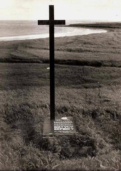
Cross on Bering's grave on Bering Island (Commander Islands)
The “St. Peter”, dilapidated by winter storms, was dismantled and a small evacuation vessel began to be built from its components. Since both ship carpenters had died by this time, difficulties arose during construction, since none of the officers and navigators were shipwrights. The situation was saved by the Krasnoyarsk Cossack Savva Starodubtsev, who took part in the construction of packet boats in Okhotsk. With his help, it was possible to build a small ship, also called “St. Peter”. Subsequently, according to Vaksel’s report, Starodubtsev was awarded nobility for these services. On August 9, 1742, the new “St. Peter” was launched. On August 13, the travelers left the island that sheltered them and on the 29th of the same month they safely reached the Peter and Paul prison in Kamchatka.
The voyage of the packet boat "St. Paul" turned out to be shorter and ended safely. Having lost sight of his flagship, Alexey Chirikov, on the night of July 14-15, noticed land that turned out to be a group of islands. 11 who landed on the shore, and then 4 more people went missing along with the boats, which made the task of replenishing fresh water difficult, and on July 25 the decision was made to return to Kamchatka. Having sailed along the Aleutian Islands, on October 10, 1741, “St. Paul” returned to Petropavlovsk.
Real image of Vitus Bering
For a long time, the exact burial place of Vitus Bering remained unknown. In 1991, when it was the 250th anniversary of Bering and Chirikov’s voyage to the shores of America, the Adventure club, led by the famous journalist and researcher Dmitry Shparo, together with the Institute of Archeology of the USSR and with the support of others, including Danish organizations, carried out an expedition to the island Bering. As a result of the excavations, the grave of the captain-commander was found, his remains were removed and transported to Moscow for examination. They were subsequently returned and reburied on Bering Island. As a result of the research, it was possible to restore the true appearance of the famous pioneer. The famous image supposedly of Vitus Bering actually belongs to his uncle, a Danish court poet of the 17th century. The original appearance of the captain-commander was restored.
For almost three years, the Ryazan Higher Airborne School has been commanded by Anatoly...

Applications of superconductors: Powerful electromagnets operating without the cost...

The Venera 8 spacecraft can be seen in the background. For it and for Luna-9 I will have two...